Thursday, August 31, 2017

Craggaunowen - Fulacht Fia


Fulacht Fia
This reconstructed cooking site was common throughout Ireland. Hunting parties used them over a long period of time, from the Bronze Age to the Elizabethan period. A rectangular hole was dug in low-lying land where it was sure to fill with water. This was clad on the four sides with wooden sections.
Stones heated on the campfire were then used to boil the water in the wooden trough. A joint of venison was then wrapped in straw and put into the boiling water and cooked for a set period.

-Shannon Heritage-
-The Living Past Experience-


Craggaunowen Crannóg


Exploring the Crannóg - an artificial island dwelling defended by a hidden pathway in the water.
At Craggaunowen you gain insight into how the Celts made their homes on a Crannóg (young tree), a reconstructed lake-dwelling or artificial island on which people built houses, kept animals, and lived in relative security from enemy clans or invaders. Crannógs were found in Ireland during the Iron Age and early Christian periods. Though some homesteads were inhabited during the Late Bronze Age and in some cases were still being occupied as late as the 17th century.
-Shannon Heritage-
-The Living Past Experience-


Following the path to the Crannóg...


This was our first view of the Crannóg at Craggaunowen. It was quite an amazing sight!
We walked along the outer fencing to a short bridge that lead us to the dwelling site.


The forest and water lilies were beautiful!


The Community Fire Pit 
 It's usually cool enough, even in the summer months, in Ireland for an outdoor fire.


The inside ceiling of one of the dwellings was so perfectly symmetrical.

.
Mud Walls and Symbolic Painting


Detail


Crannógs were constructed by placing layers of stone, brushwood, tree trunks and even old dugout canoes, on the lakebed. These were held together by wooden pilings and the platform was covered with a layer of dirt or sand. On this the inhabitants built their thatched houses of wattles and mud and surrounded themselves with a protective timber fence.
-Shannon Heritage-
-The Living Past Experience-


Thatch Roof and Protective Fencing


The second dwelling was larger and more elegant. 
Those of higher social status apparently occupied this one.


The artificial islands are generally approached by dugout canoes or by various causeways or bridges.


Wednesday, August 30, 2017

Craggaunowen


Turtle shells were used as bowls.


A spiral staircase leads to an upper level.


Windows and plants growing on the sides of the walls.


Wool


The Castle Tower

Craggaunowen


The Living Past Experience
The open-air museum was started by John Hunt. 
It features reconstructions of ancient Irish architecture, including a Dolmen, a Crannog, and a Currach boat used in Tim Severins recreation of "The Voyage of St. Brendan the Abbie". It also shows reconstructions of a Ringfort, Fulachta Fia (Bronze Age cooking and industrial site) and Standing Stone (Ogham Stone).


The "You Are Here" Map


The Craggaunowen Gift Shop is an historic Irish Cottage.
It was cool enough for an early morning fire in the fireplace.
It smelled wonderful in the forest.


Our tour began with a short walk from the gift shop to the Craggaunowen Castle.
It was built around 1550 by John MacSioda MacNamara, a descendent of Sioda MacNamara, who built Knappogue Castle in 1467.
It was left in ruins and without a roof or staircase in the 17th century.
Tom Steele, a confederate of Daniel O'Connell, had it rebuilt in the early 1800s.


Woven materials are displayed. 


Oh What A Beautiful Morning!


The view as we stepped out our door each day in Bodyke, County Clare, Ireland
(Sometimes it was raining, though.)


Tuesday, August 29, 2017

Poulnabrone Dolmen


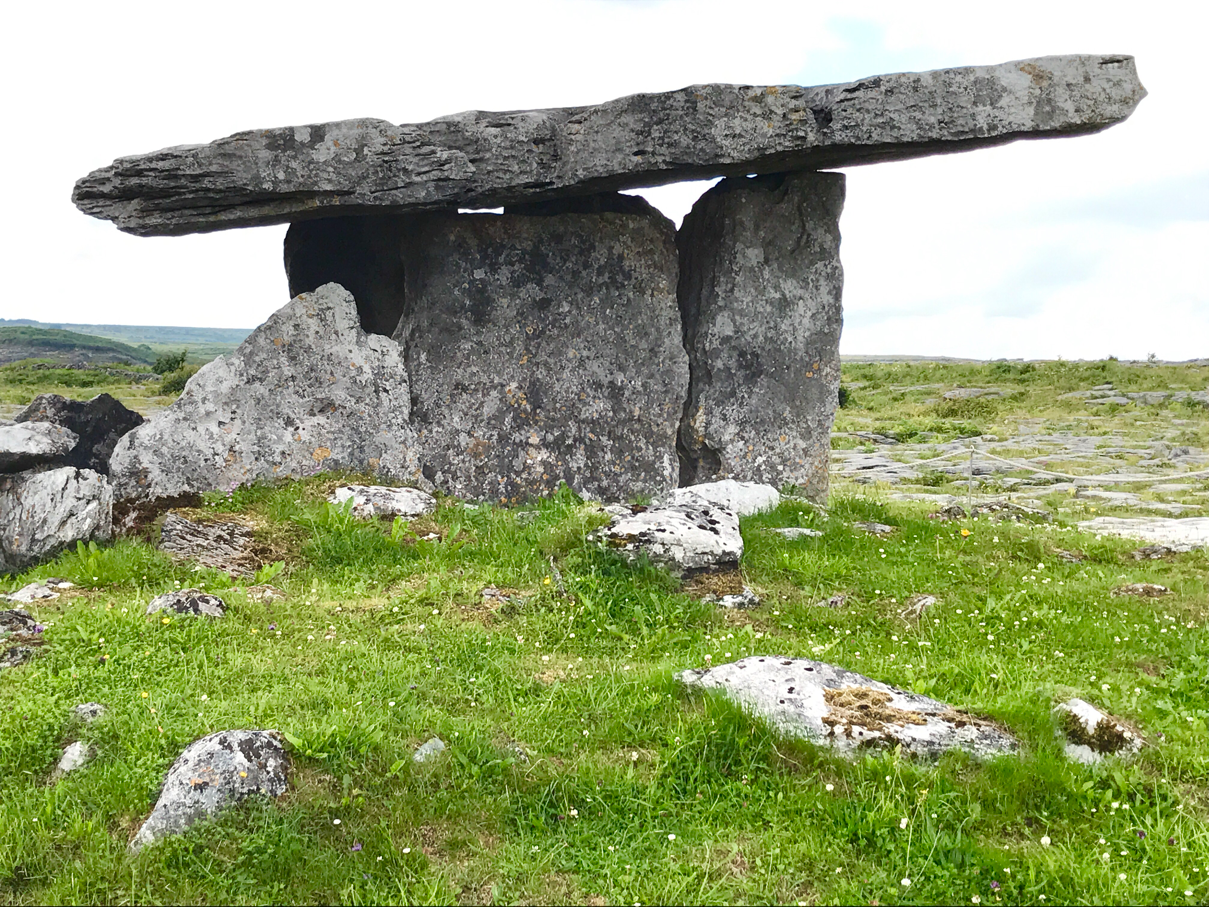
Dolmens, properly called Portal Tombs, mark burial places in a very distinctive way, with large capstones elevated at an angle and held up by huge standing stones. 
They were created between 3,000 and 2,000 BC and are generally held to be tombs, though they may also have had a ritual significance.
The stones we see now would have originally been covered in earthen mounds, with the area below the capstone forming an entrance leading to the tomb proper. Hence the correct name of Portal Tombs.
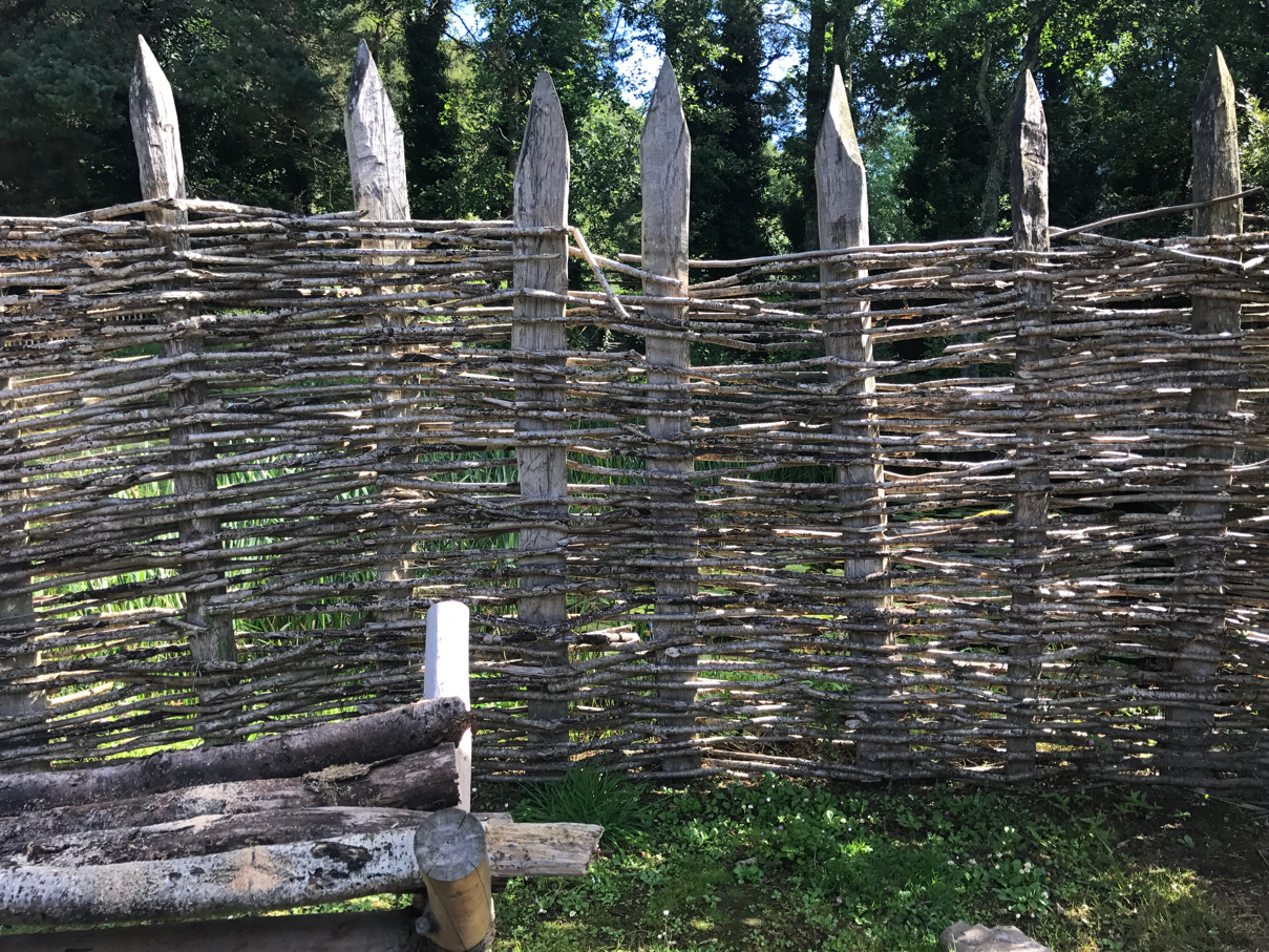
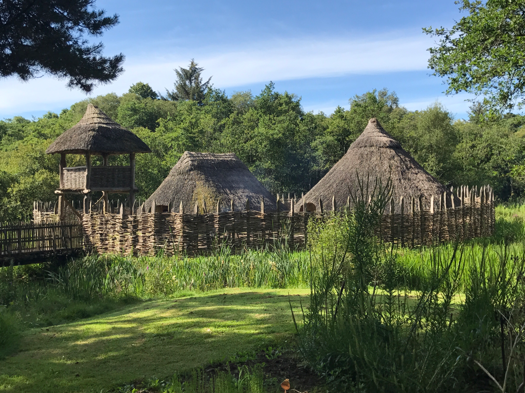
There are more than 100 dolmens scattered throughout Ireland, in various stages of repair.
How the people of the time manipulated the truly massive capstones into place is unknown, but the fact that so much of their work still stands some 4,500 years later is a testament to their evident skill.
-DoChara-
-Insider Guide to Ireland-


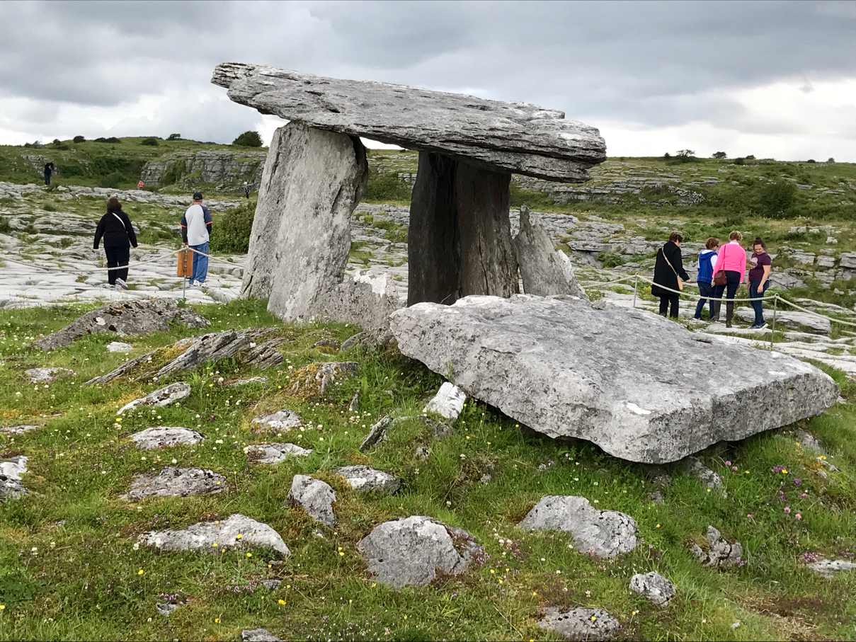
The Poulnabrone Dolmen is one of the finest remaining dolmans in Ireland. It is also one of the most visited.
In 1986 when the area around the Dolmen was excavated, the remains of 16 adults and children were found to have been buried there, over a period of perhaps 500 years.
Along side them were many artifacts, including arrowheads and axes, stone beads and broken pottery. This allowed archeologists to date the Dolmen with some confidence to about 2,500 BC.
-Do Chara-
-Insider Guide to Ireland-


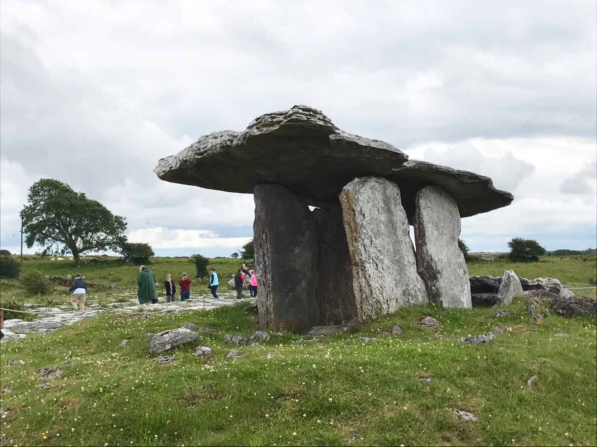
The region where the Dolmen stands, the Burren, is a treasure trove of Stone Age remains, with some 70 tombs and about 500 circular forts.
-Do Chara-
-Insiders Guide to Ireland-


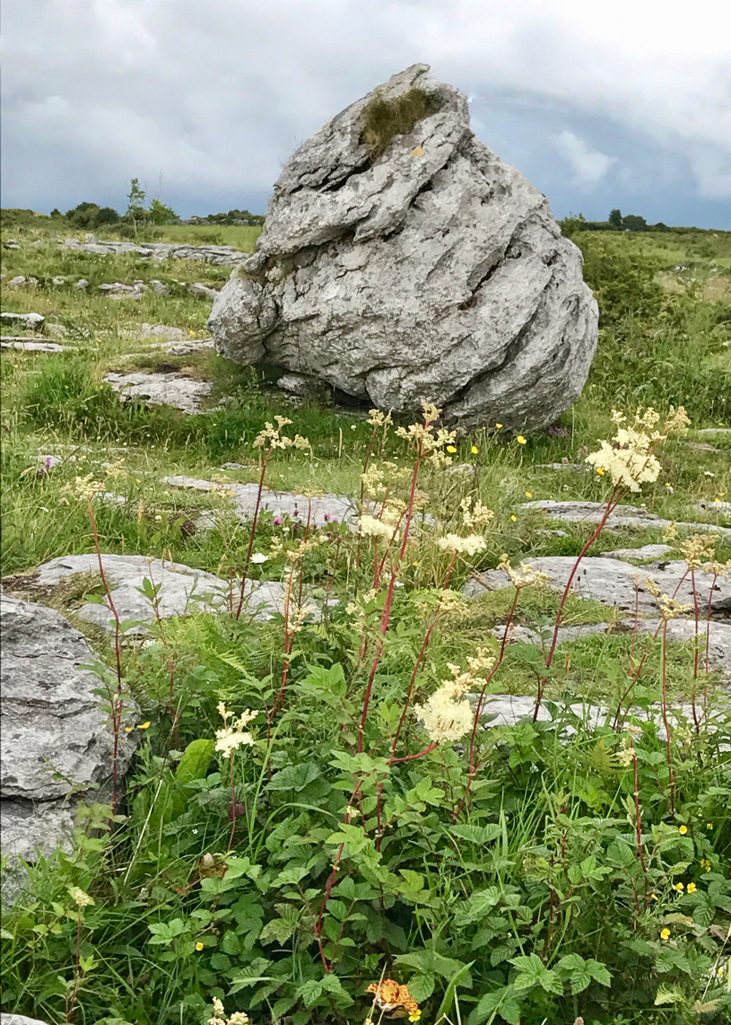
This large rock that stands beside the path to the dolmen is an example of a glacial erratic.
Large boulders such as this are scattered throughout the Burren and they were deposited here as the last ice sheets melted.
They were originally ripped up as the massive ice sheets moved across the land and scoured the surface. While many of these boulders have come from the Burren, other granite and sandstone erratics have been carried here from Galway and east Clare.
-Burren and Cliffs of Moher-
-GeoPark-

Poulnabrone Dolmen


Poulnabrone Dolmen, County Clare, Ireland


Glacial-Karst Landscape
This landscape is the combined result of glacial activity and rainwater dissolution. The limestone pavement has been scraped clean by moving ice sheets and the blocks of limestone known as clints are separated by fissures known as grikes. The grikes are formed by rainwater dissolving thin calcite veins that permeate the limestone. While the last ice sheets melted here almost 16,000 years ago and the karst process had been active since then, there is evidence that karst processes were operating in warner interglacial periods before the last ice age.
-Burren and Cliffs of Moher-
-GeoPark-


Monday, August 28, 2017

The Burren


Driving through the Burren region of North County Clare is spectacular!

Stretching across northern Clare, the rocky, windswept Burren region is a unique striated lunar-like landscape of barren grey limestone that was shaped beneath ancient seas, then forced high and dry by a great geological cataclysm. It covers 250 sq km of exposed limestone, and 560 sq km in total.
(Lonely Planet)


Wild flowers in the spring give the Burren brilliant color against its stark beauty. (Lonely Planet)
Unfortunately, it's July so we missed the wildflower season.


There are homes dotted around the landscape. 
Villages throughout the region include the music hub of Doolin on the west coast, Kilfenora inland and charming Ballyvaughan in the north, on the shores of Galway Bay. (Lonely Planet)


South of Ballyvaughan, a series of severe bends twists up Corkscrew Hill (180m). Built as part of a Great Famine relief scheme in the 1840s, the road leads to prehistoric and Iron Age sites including Gleninsheen Wedge Tomb, Poulnabrone Dolmen and Caherconnell Fort. (Lonely Planet)


Burren Gold Cheese


Burren Gold Cheese
Aillwee Cave Farm Shop in Ballyvaughan has been the production site for the award winning Burren Gold Cheese since 1985.
Milk for the farmhouse cheese comes from a local farm where their Friesian Dairy Herd graze on rich grasses and herbs of the Burren region of North County Clare, Ireland.
We sampled and bought several different flavors of their Burren Gold Cheese and then crackers and wine from a local grocery store.
Yummy!


Saturday, August 26, 2017

Grand View


We stepped outside of the Aillwee Cave and this was the view. 
Simply Grand!


Aillwee Cave2


We have seen a lot of caves and this one seemed a little dull in comparison but it was interesting.


The waterfall was my favorite part.
We could hear it's sound echoing through the chambers.
My shadow shows me taking this photo.


Our guide shines his flashlight on the walls and I liked the effect!